Field studies of the transboundary Ugam River in Turkestan region were carried out under the GIZ project
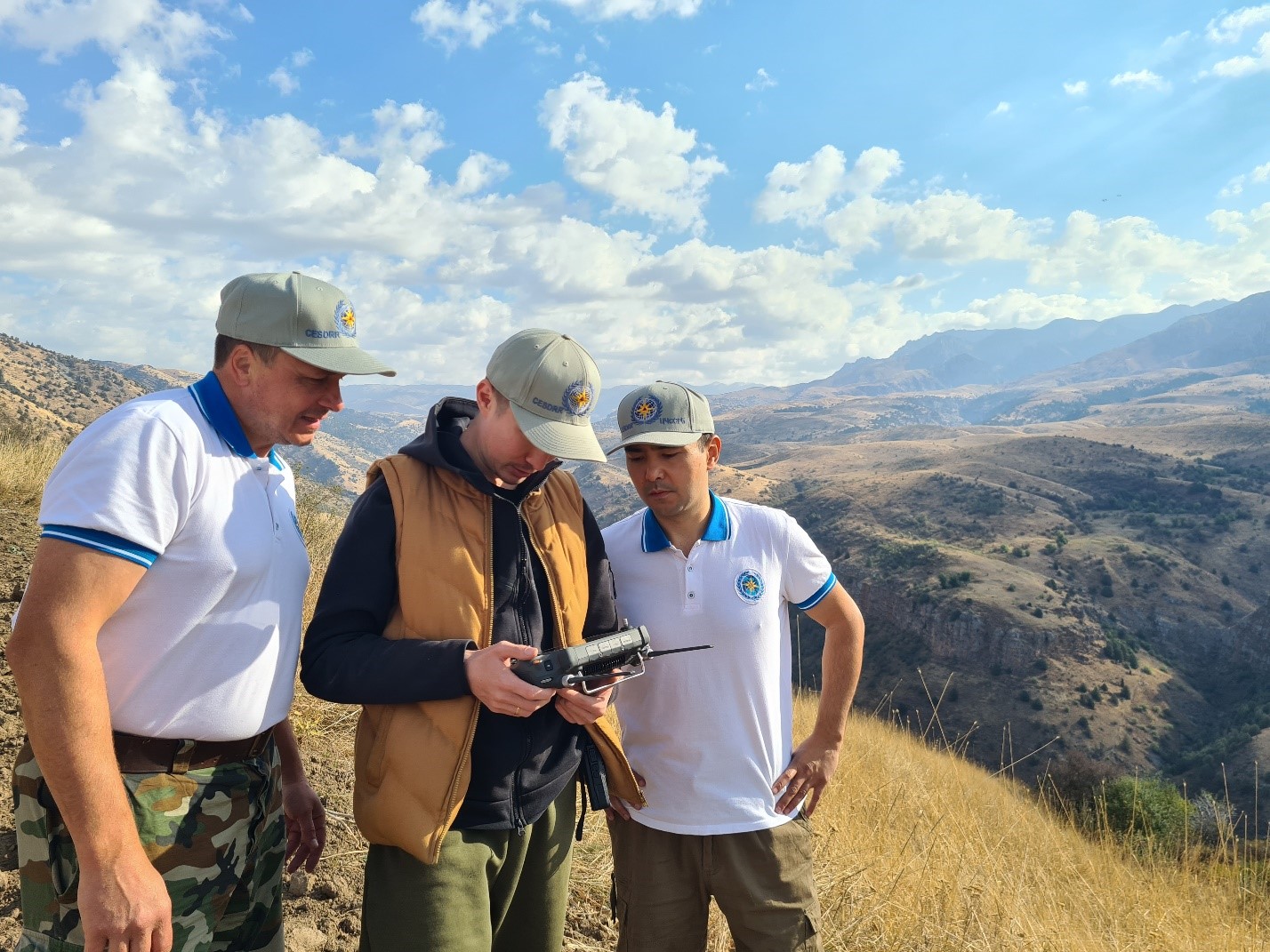
Within the period from September 30 to October 8, as part of the implementation of the project of the Center and GIZ "Strengthening the Capacity for Safe Management of Transboundary Water Resources in Central Asia through the Use of Innovative Information and Communication Technologies," a team of experts, consisting of the expert on EWSs V. Kuchkin, Senior Expert of the Center B. Ospanov, and System Administrator of the Center A. Ospanov, conducted field research on the transboundary Ugam River, located in the Sairam-Ugam National Park in Turkestan Region.
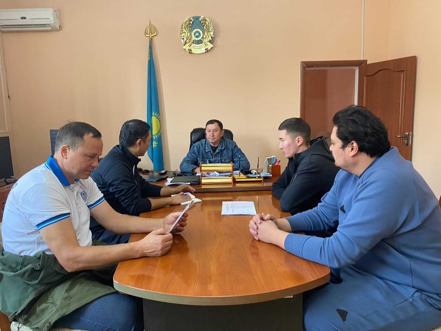
On October 1, 2024, representatives of the Center held a working meeting with the head of the Southern Territorial Technical Operational Administration (STTOA) of the "Kazselezashchita" State Enterprise under the Ministry of Emergency Situations of the Republic of Kazakhstan, Mr. E. Alzakov. During the meeting, Mr. Alzakov informed that the hydro-engineer of the STTOA of "Kazselezashchita" S. Omar, Head of the Kazygurt Operational Department of the STTOA of "Kazselezashchita" E. Nursiyet, and observer of the Ugam Hydrological Post of the STTOA of "Kazselezashchita" O. Berkimbayev would also participate in the field research.
On the same day, the expert group held a series of meetings with the management of the Sairam-Ugam State National Nature Park and the head of the Department of Emergency Situations (DES) of Kazygurt District, Civil Protection Colonel D.K. Talipbayev. During these meetings, the representatives of the involved bodies confirmed the need for research on the Ugam River to improve the hydrological monitoring system and to create a transboundary early warning system for hydrological hazards.
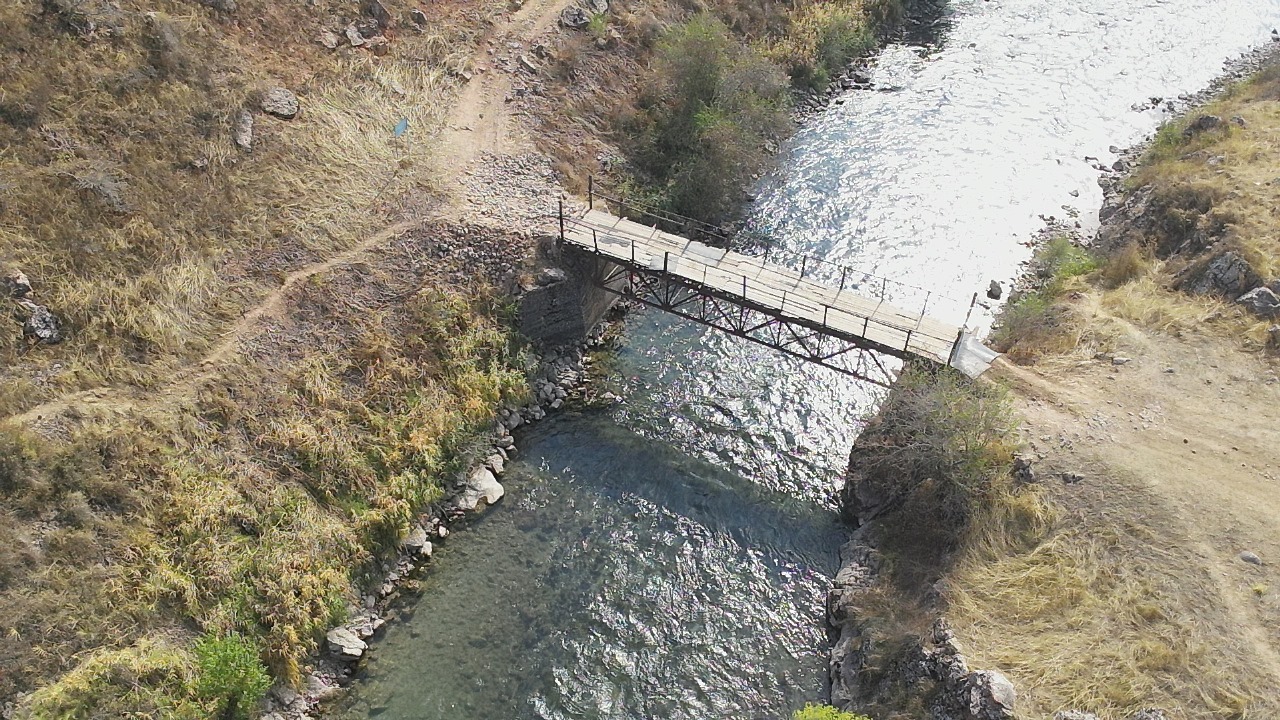
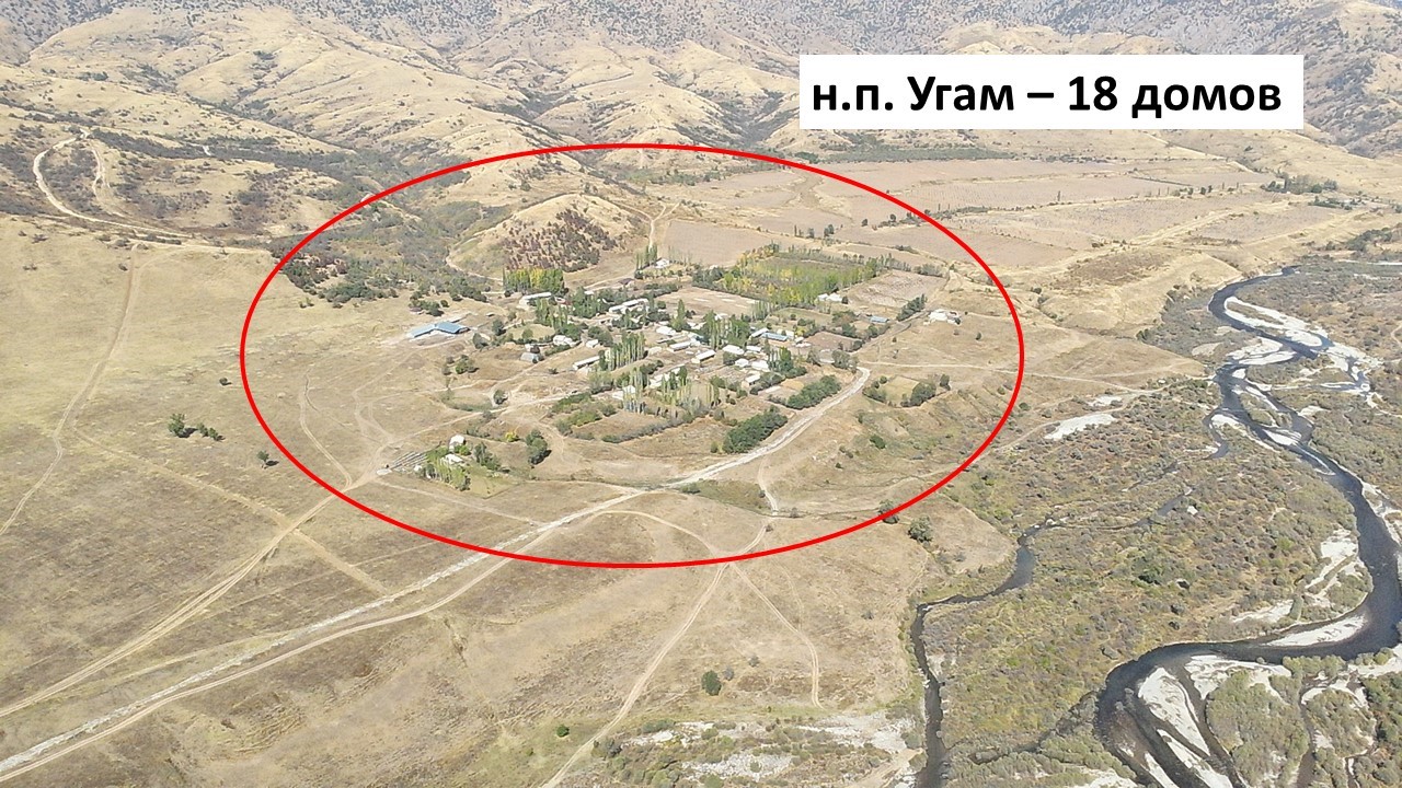
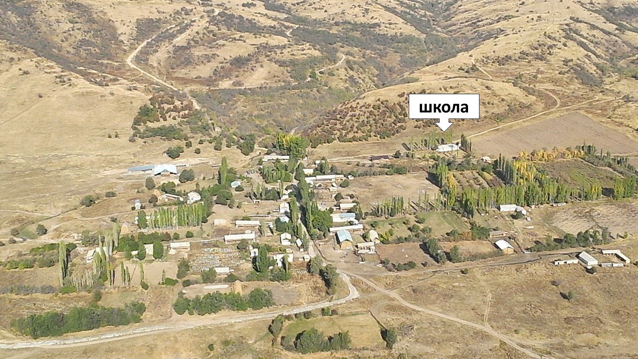
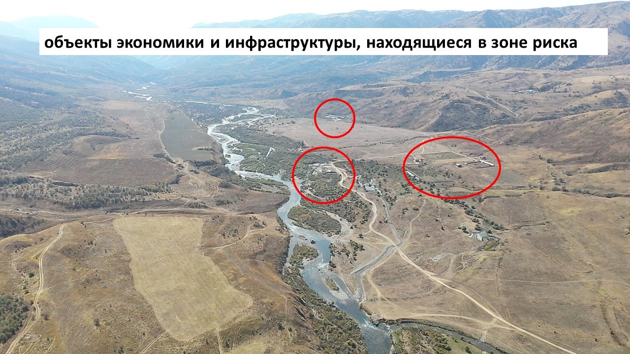
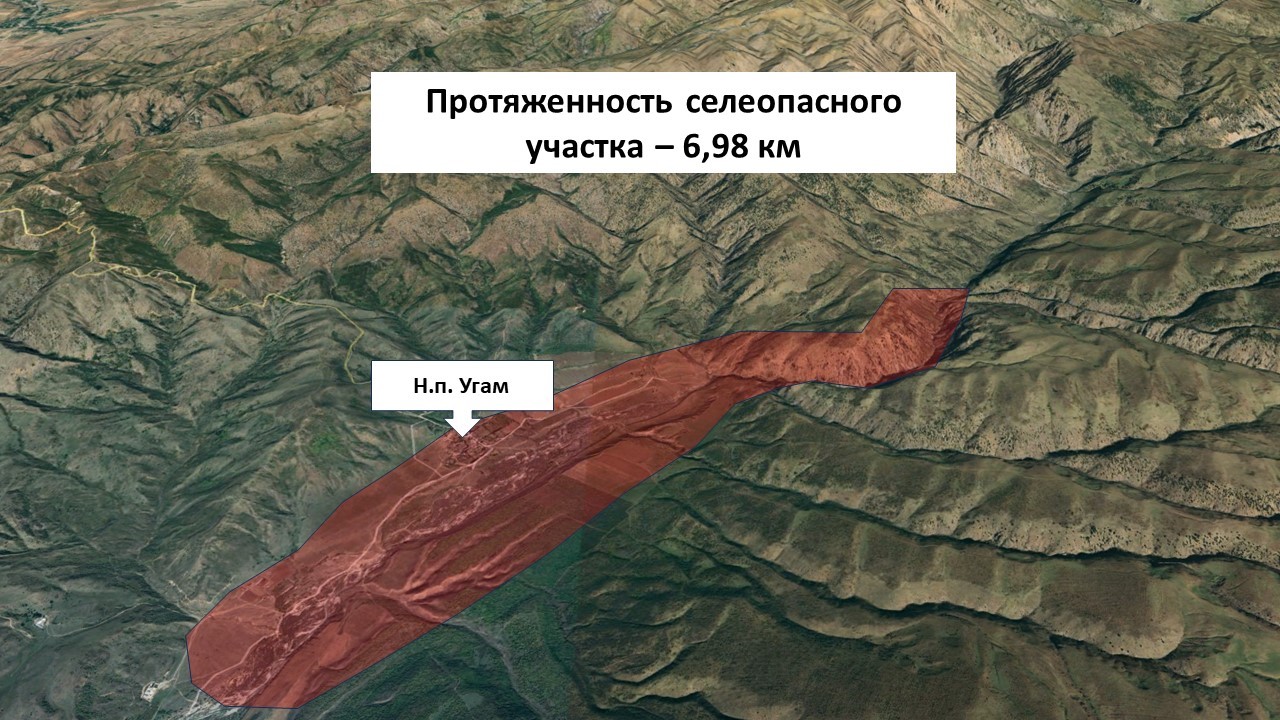
The degree of mudflow risk in the Ugam River basin, according to civil protection authorities, is considered high. There is one mudflow-prone section and two moraine lakes in the basin. The potential negative impact may affect 22 objects, including 18 residential houses, one school, a pedestrian bridge, and a vehicular bridge, as well as a forest plantation. There are 56 people living in the risk zone, and the possible affected area covers 130,000 m². Additionally, one landslide-prone area and one avalanche site were identified in the Ugam River basin, posing a threat to six objects (four residential houses, a school, and a hunting lodge), where 11 people live or work.
All these objects are located in the village of Ugam in the Kazygurt District of the Turkestan Region, where 56 people live (including 15 women and 16 children).
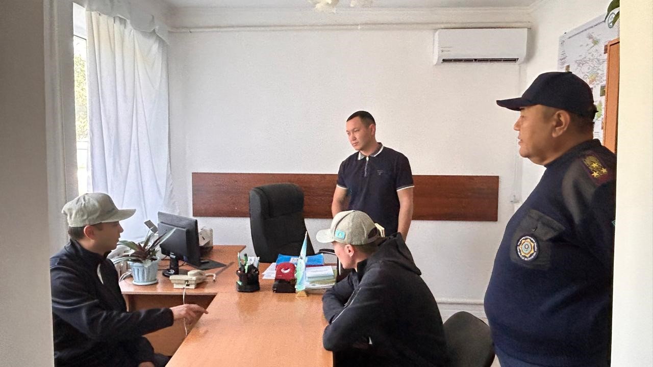
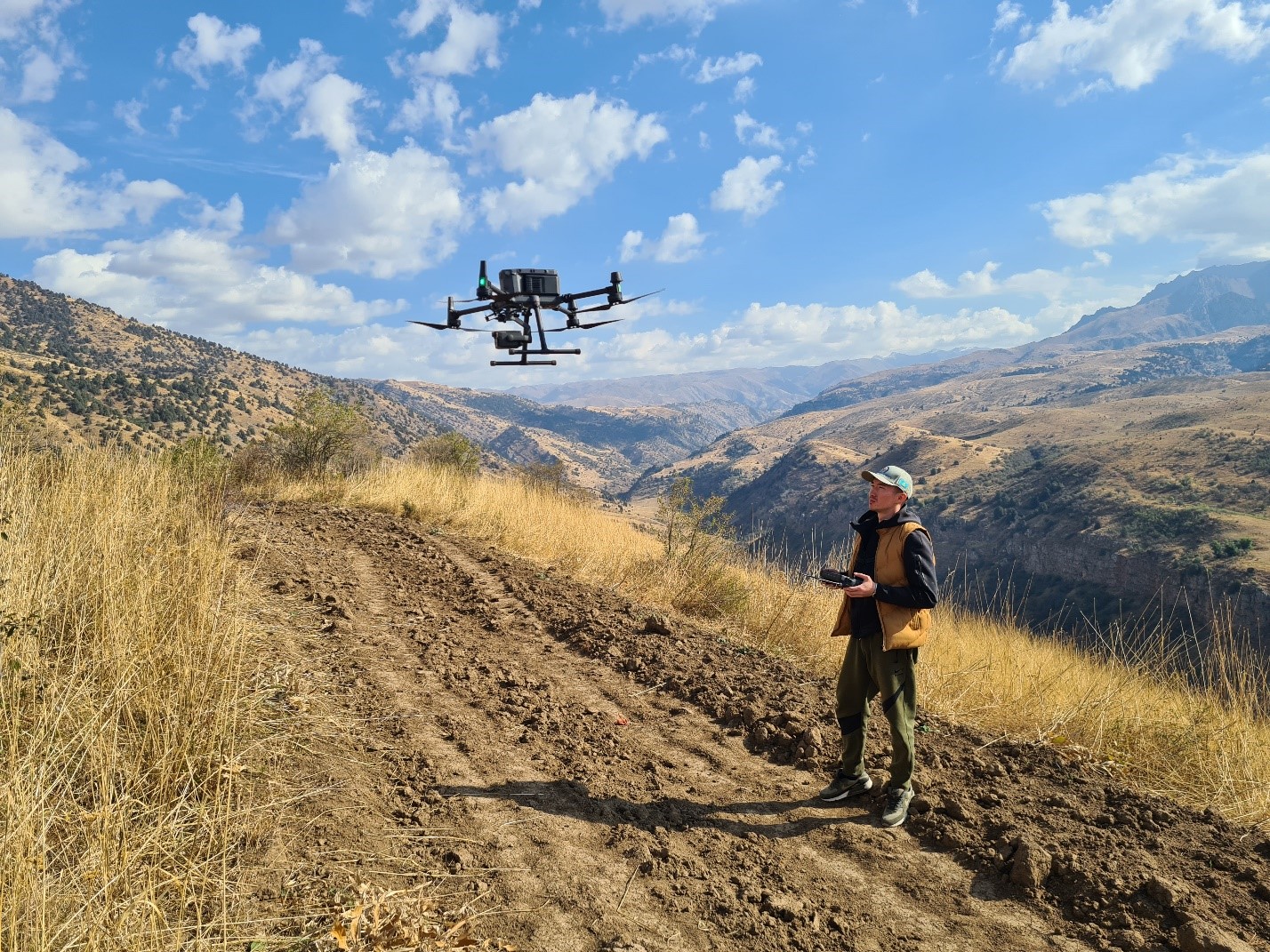
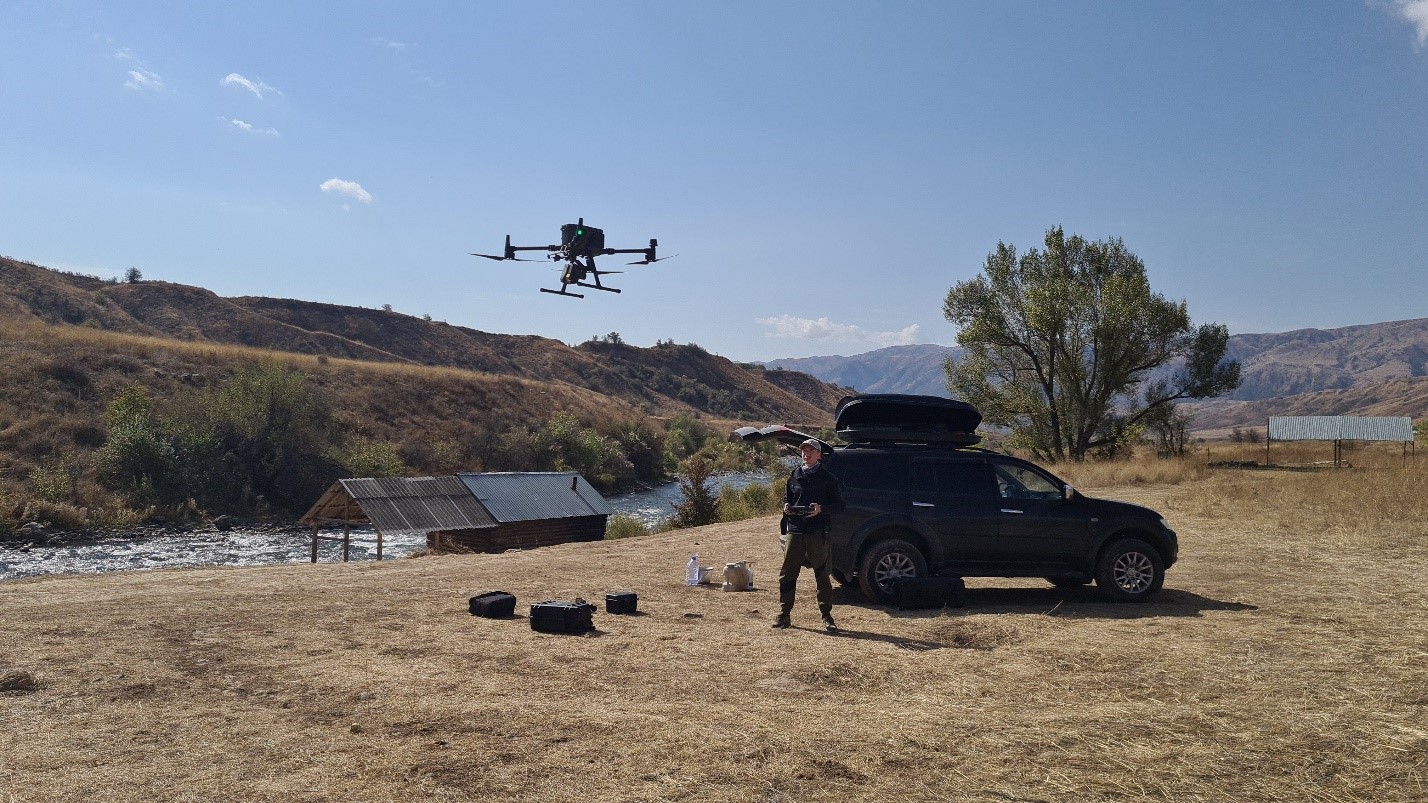
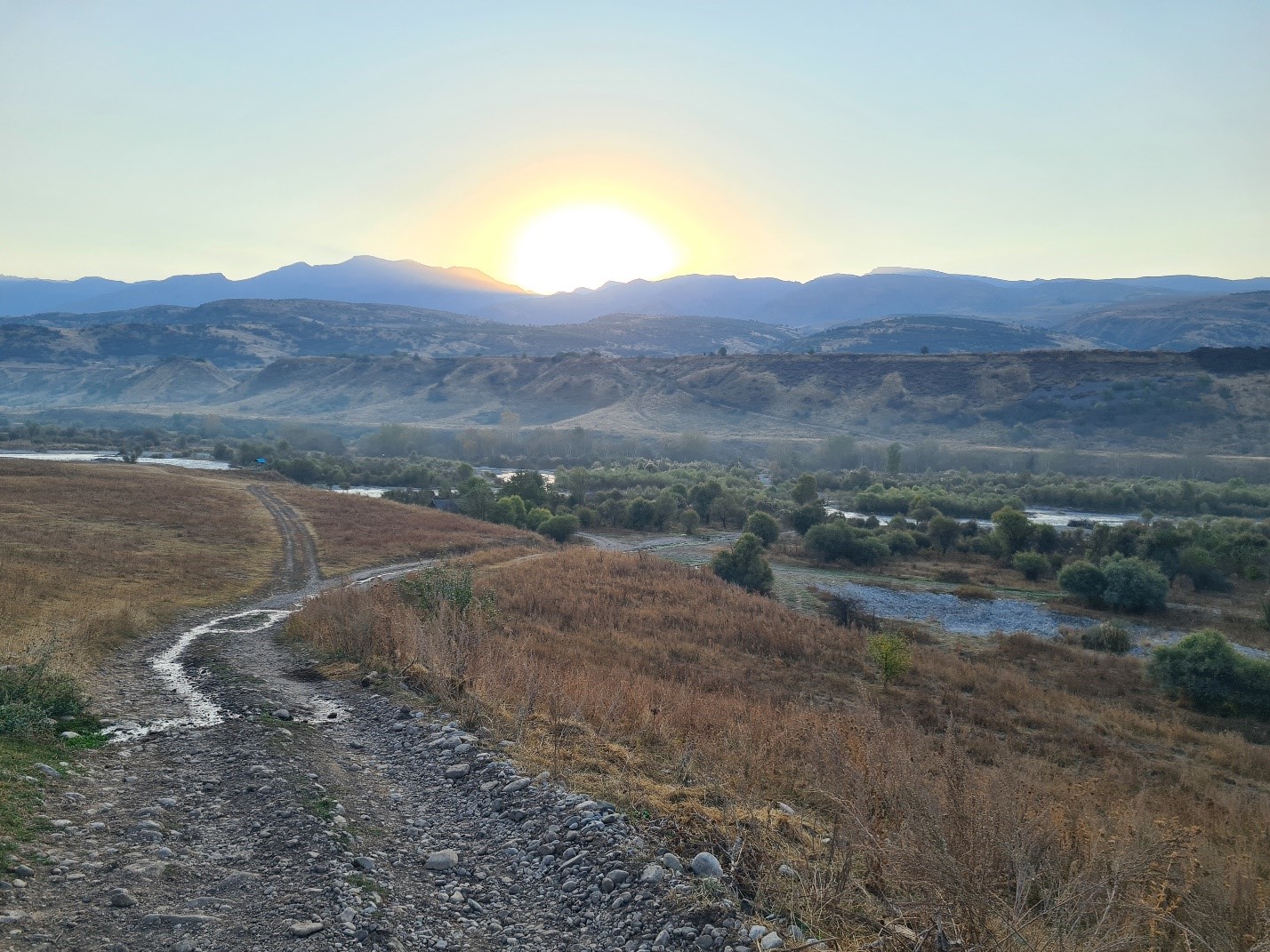
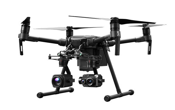
In this regard, over seven days, the expert group, together with representatives of "Kazselezashchita", the DES of Kazygurt District, and the national park, conducted research using the Center's unmanned aerial vehicle (UAV).
As a result of the field research, a survey was carried out of the mudflow-prone section near the village of Ugam, and a 3D model of the Ugam River basin, stretching over 5 km, was prepared.
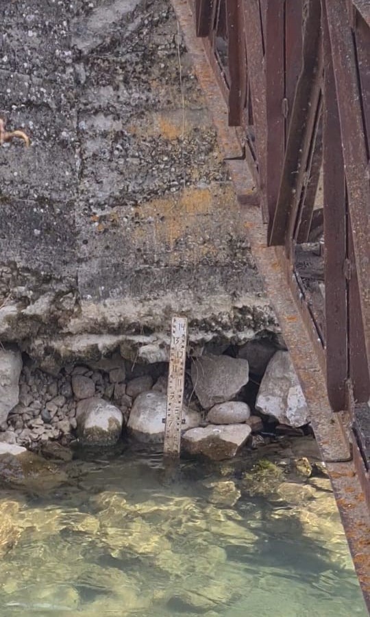
During the research, it was established that the hydrological posts of the "Kazhydromet" State Enterprise and the "Kazselezashchita" State Enterprise are equipped with vertical water-level gauges and outdated mechanical meteorological instruments such as rain gauges, thermometers, and barometers. Due to the lack of telephone and internet connectivity in the village of Ugam, the observer transmits hydrological data three times a day to the Kazygurt Operational Department of the STTOA using a radio station. However, in adverse weather conditions in the mountainous area, communication breakdowns frequently occur.
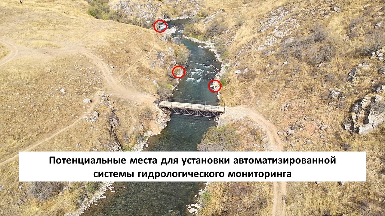
To improve hydrological monitoring by eliminating the human factor and to subsequently create a transboundary early warning system for hydrological hazards, the experts proposed installing an automated monitoring station at the existing hydrological posts of "Kazselezashchita" and "Kazhydromet." The station should be capable of transmitting real-time data to improve rapid response and be equipped with the following sensors:
- Rainfall sensors (rain gauges or pluviometers) to measure the amount and intensity of precipitation;
- Water level sensors to measure the water level in the river;
- Water flow sensors (flow meters) to measure the flow speed and volume of water passing through a specific section of the river;
- Soil moisture sensors to measure the saturation level of the soil. In mountainous areas, this is especially important for preventing landslides, as oversaturated soil loses stability and can shift;
- Meteorological sensors:
- Temperature sensors for measuring air and water temperature, which is crucial for assessing snowmelt and its impact on runoff;
- Anemometers for measuring wind speed and direction, necessary for evaluating evaporation and precipitation distribution;
- Water pressure sensors (hydrostatic sensors) for determining hydrostatic pressure at the riverbed, allowing accurate assessment of water level changes and potential surges;
- Water turbidity sensors to measure the concentration of suspended particles in the water. Increased turbidity may indicate the onset of a mudflow, especially when the flow rate rises after rainfall;
- Snowpack sensors to measure snow depth and water content, helping forecast the volume of meltwater that may enter the river;
- Surveillance cameras for visual monitoring of the river and its banks;
- Inclination sensors (inclinometers) to monitor slope changes, assisting in landslide prediction.
Furthermore, to verify the information from the automated stations and promptly transmit confirmations, the experts proposed equipping the observation post with satellite internet and the necessary computer equipment.
Thus, the installation of an automated hydrological monitoring station on the Ugam River is a key element in creating a transboundary early warning system, as it will allow real-time data collection, timely identification of critical conditions, automated data processing and analysis, integration with digital forecasting models, and information transmission to the servers of "Kazhydromet," "Kazselezashchita," the Ministry of Emergency Situations of the Republic of Kazakhstan, and alert systems via satellite internet.
The Center for Emergency Situations and Disaster Risk Reduction expresses its gratitude to the management of "Kazselezashchita", the Southern Territorial Technical Operational Administration of "Kazselezashchita", the Department of Emergency Situations of the Turkestan Region, the DES of Kazygurt District, and the Sairam-Ugam National Nature Park for their comprehensive support during the field research of the Ugam River basin.