How a mudflow hazard forecast is formed on the basis of the Center's initial data
Situational-analytical note
To: Ministry for Emergency Situations of the Republic of Kazakhstan.
From: Akmolasvyazmontazh LLP (GIS Emergency GIS).
Problem: Probable spillage of moraine lake No.5 in Almaty region.
Survey: Based on requests from the Central Emergency Situations Center of the Ministry of Emergency Situations of the Republic of Kazakhstan and the State Institution "Kazselezaschita", on July 25, 2024 the Center for Emergency Situations and Disaster Risk Reduction in Almaty made an aerial survey of moraine lakes No. 5 and No. 2 located in the basin of the Turgen River using the Center's UAV (detailed information on the aerial survey).
These surveys were conducted to assess the mudflow situation in the Ile Alatau Ridge area from the Kaskelen River basin to the Turgen River basin. As part of the survey, the condition of the glacier was inspected, and an orthophoto and 3D terrain model of moraine lake No. 5 was made. Then the data were transferred for modeling of the situation to analysts of "Akmolasviazmontazh" LLP, located in the Central Emergency Situations Department of the Ministry of Emergency Situations of the Republic of Kazakhstan to carry out calculations of possible scenario and identification of risks and threats.
Data:
Terrain survey over moraine lake #5 was conducted on 25-07-2024. For a total area of 1,555 m2.
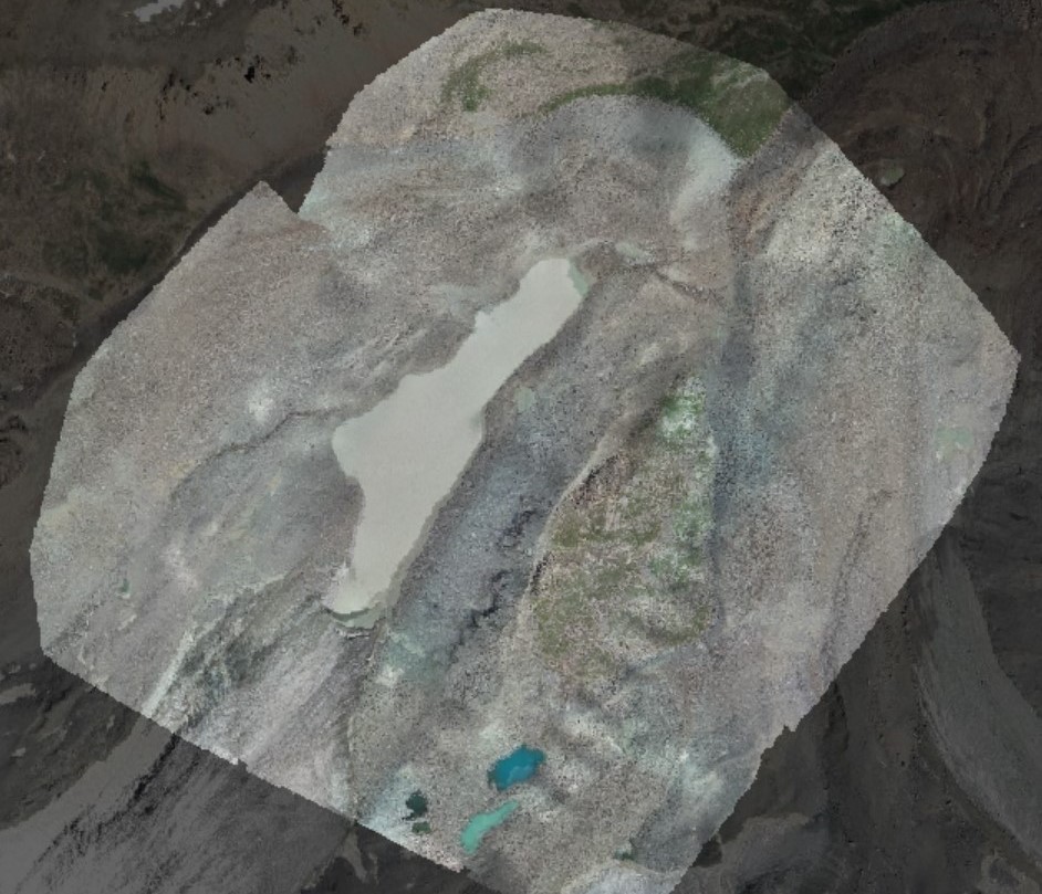
Ortho-photo plan of the terrain
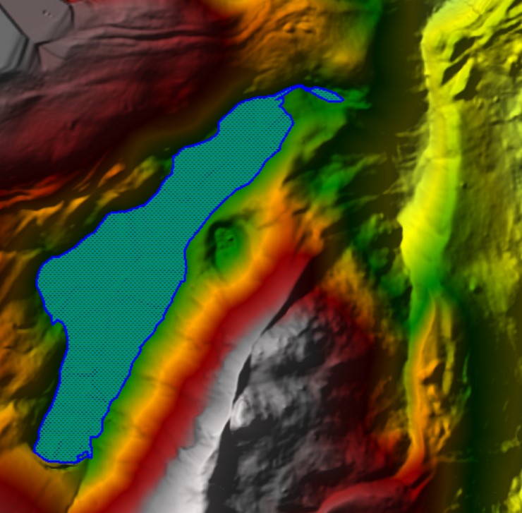
The maximum elevation difference is 232 meters, ranging from 3,327 to 3,559 meters.
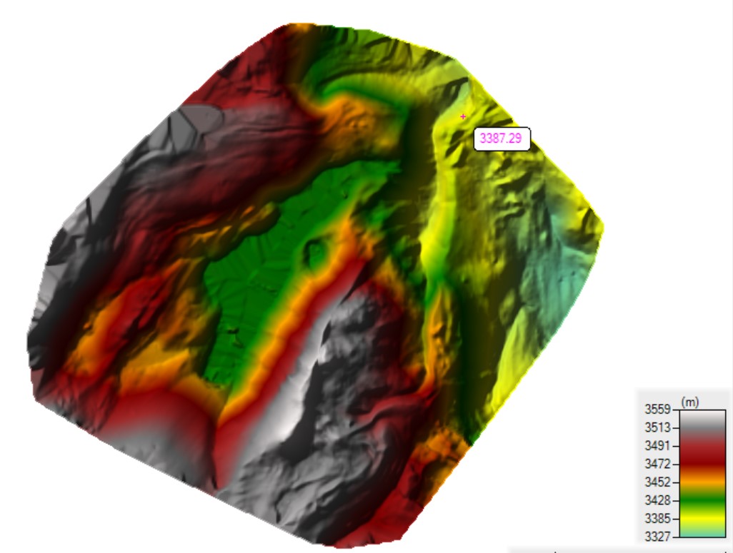
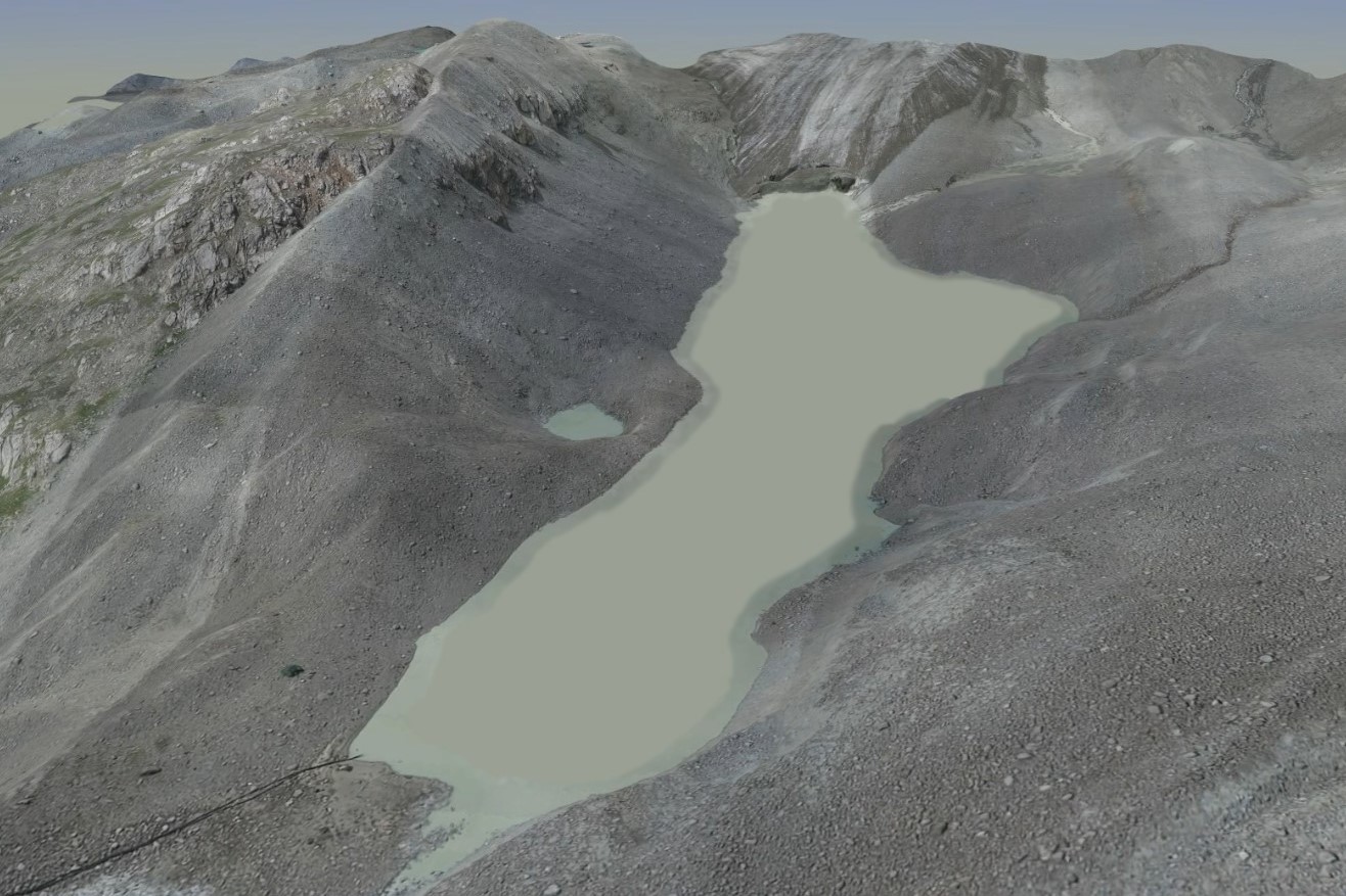
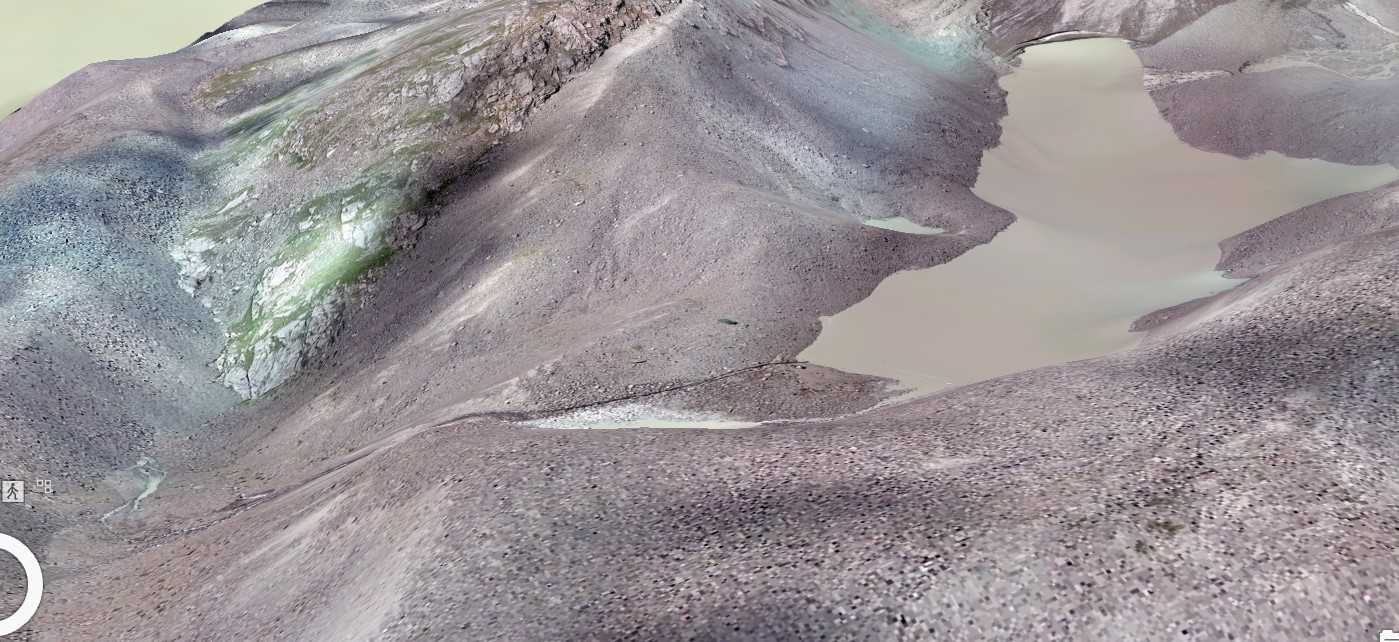
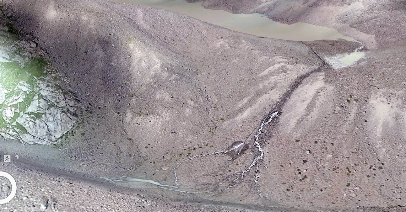
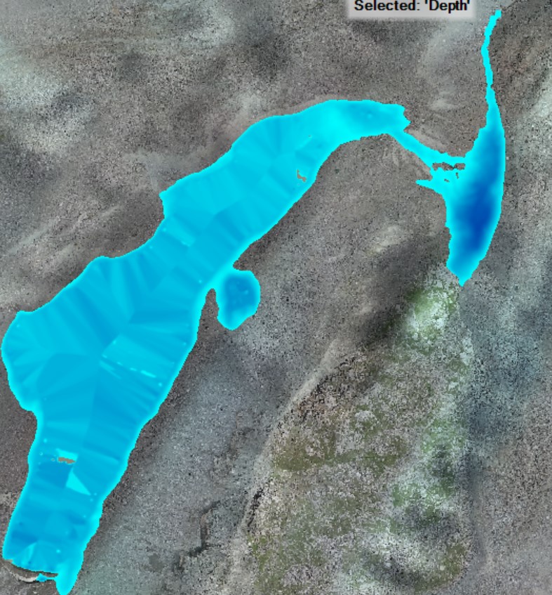
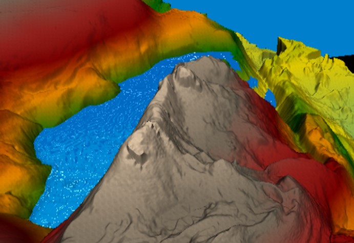
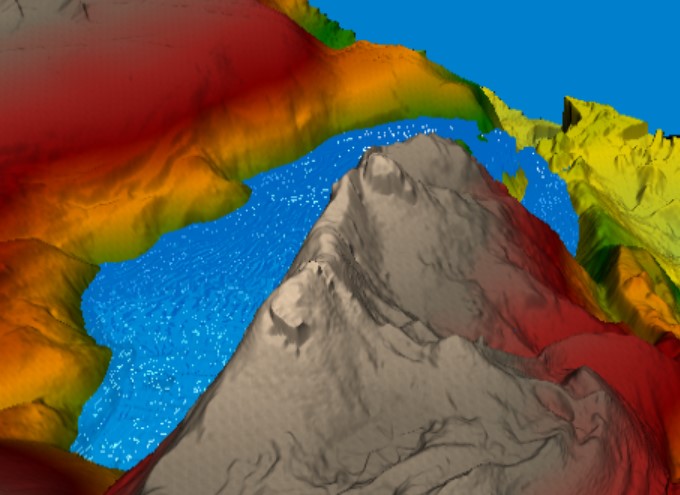
Digital terrain model
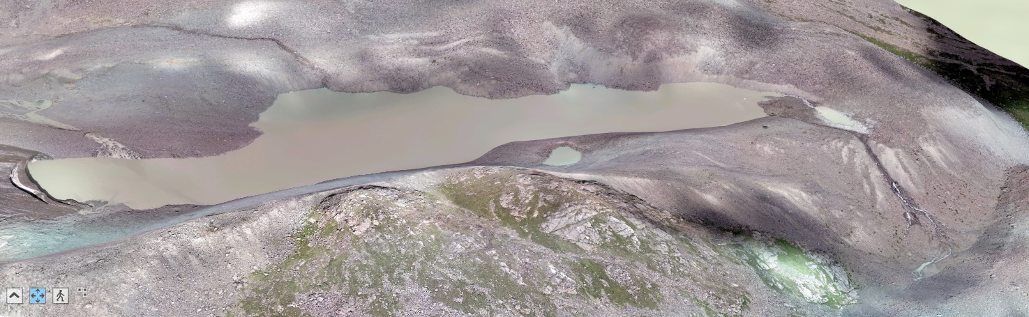
General view from north to south
General view from south to north
Enlarged view from south-west to north-east
Enlarged view from northeast to southwest
The depression is not currently filled with water.
Analysis:
According to the orthophoto of the terrain obtained from the survey, the area of the overhanging part of the glacier at the time of the survey is - 680.764 m2
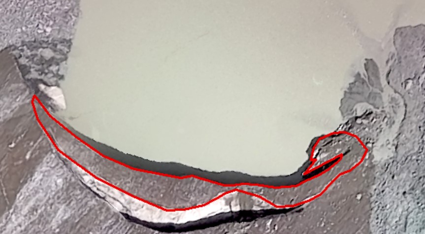
Calculation of the area of the overhanging part of the glacier
The height, according to Kazselezashita data, is 21 meters.
Accordingly, the volume at the moment of survey is 680.764 *21= 14 296.044 m3.
The volume of ice taking into account its density during melting will be equal to 13 152.36 m3 of water volume.
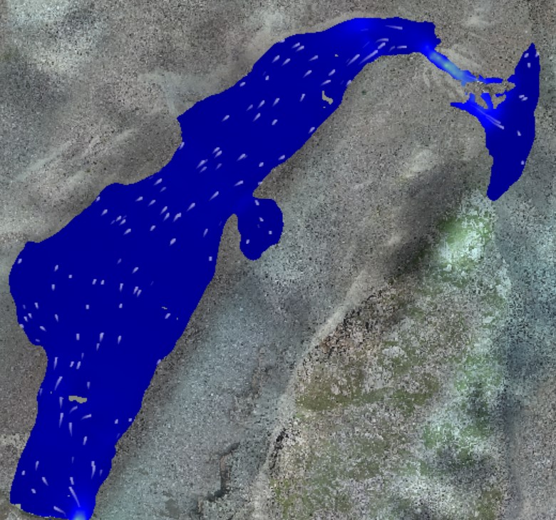
According to the orthophotomap of the terrain, obtained as a result of the survey, the surface area of the lake is - 95,194.5 m2.
The volume, according to Kazseleshchita data - 988 000 m3.
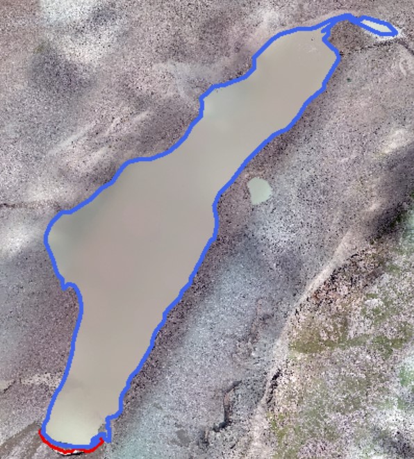
Calculation of current water surface area
Note: errors are probable, as calculations were performed in GWS-84 coordinate system.
Modeling:
Settings:
- Manning's roughness coefficient was applied - 0.2 (Mudflow-type streams consisting of mud, rocks, etc.). Deep floodplains, all forested, taiga type. Basin slopes in natural condition).
- Hydrograph - volume 20 000 m3.
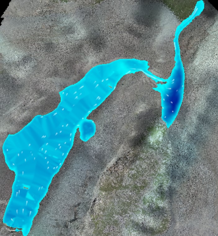
Current state
Simulation results:
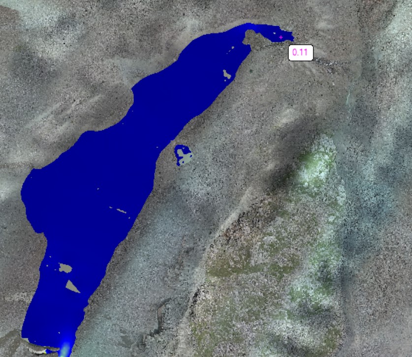
Current moment velocity 0.11 m/s and depth 1 m
Order of lake filling in case of volume increase:
1) The excavation will be filled completely and part of it will spill out into the depression
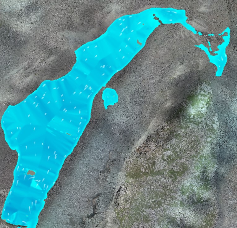
After 10 minutes: velocity 0.18 m/s and height difference 25m in the depression, velocity 0.4 m/s and depth 4m in the original pond.
Area in the depression is 4971.28 m2, cf depth is 1.5m. Volume= 7456.92 m3
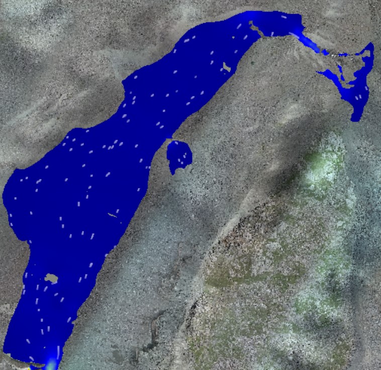
2) Further the depression and the lake will continue to fill up.
After 20 minutes: velocity 0.1 m/s and height difference 29m, in the depression average 2m.
The total water surface area is 129,471.85m2.
The area of the depression is 10025.25m2, with a mean depth of 2m. Volume= 20050.5m3.
This volume of the depression, excluding the lake, is greater than the volume of the overhanging part of the glacier, respectively, the glacier does not pose a threat.
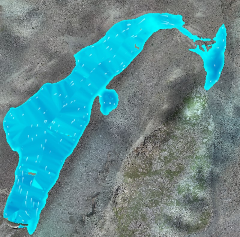
3) This depression will be filled and part of it will go down to the river bed.

After 30 minutes: the velocity of the fall into the depression is 2m/s.
4) The water flow will head down into the riverbed
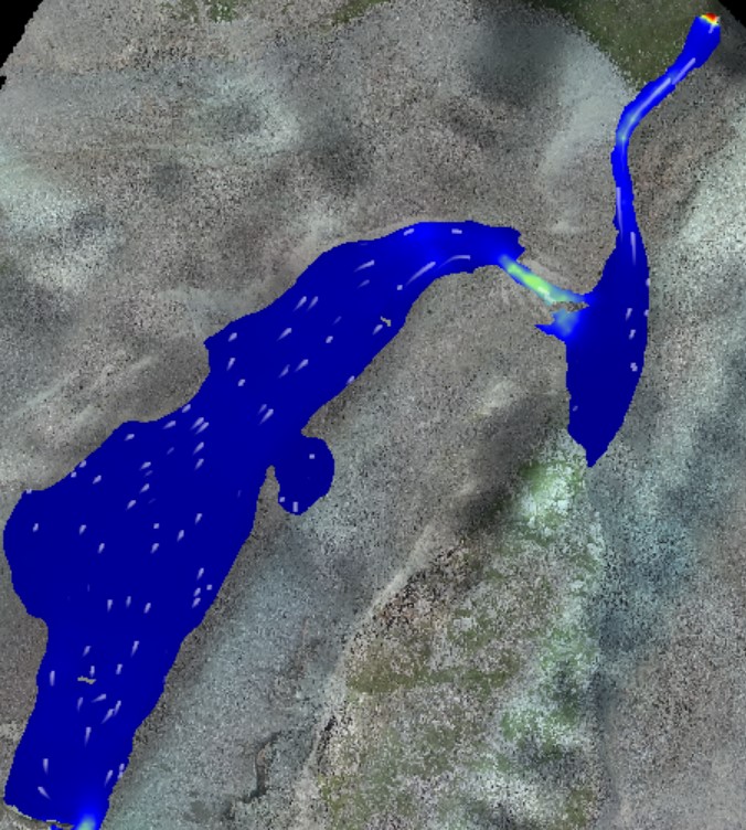
After 40 minutes: the velocity below will reach 14m/s and the depth will be 1m, the velocity from the fall into the depression will reach 4m/s
Total Water Surface Area - 146,455.7 m2.
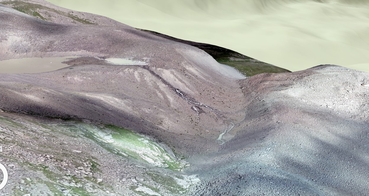
Overview in 3D
Conclusion:
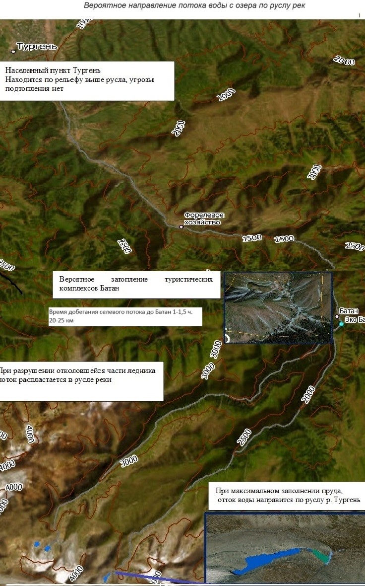
Analysis of the current hydrological conditions of the area indicates that the risk of debris flow formation is minimal. The depth of the river channel and the natural barrier structures of the terrain contribute to containment of the flow, which minimizes its kinetic energy and therefore the potential threat to the settlement of Turgen. Thus, the likely impact of the debris flow does not pose a significant hazard to the area.
Particular attention should be paid to the Batan tourist complex, which is located in the zone of possible mudflow impact. However, according to current assessments, the probability of significant impact on this site is currently low.
It is recommended to continue monitoring of hydrological conditions and terrain conditions in order to timely identify possible changes that could affect the level of risk.